
Tributary Monitoring in the Lesser Slave Watershed
Written by Lesser Slave Watershed Council
May 2, 2019
The Lesser Slave Watershed is a sub-basin of the much larger Athabasca Watershed. There is a historical lack of data and monitoring within the basin. However, the Lesser Slave Watershed Council, a Watershed Planning and Advisory Council that operates in the region, is working on changing that.
Currently the council is in their second year of a tributary monitoring program. This program, recommended in the Lesser Slave Watershed Management Plan, collects consistent quality data that will fill major data gaps and inform future land and water management decisions in the watershed.
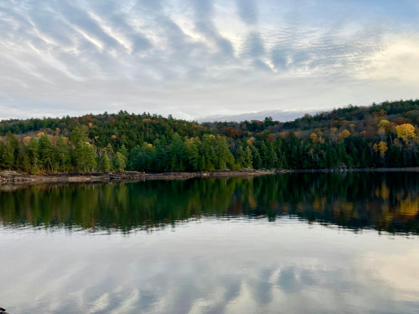
Lesser Slave Watershed
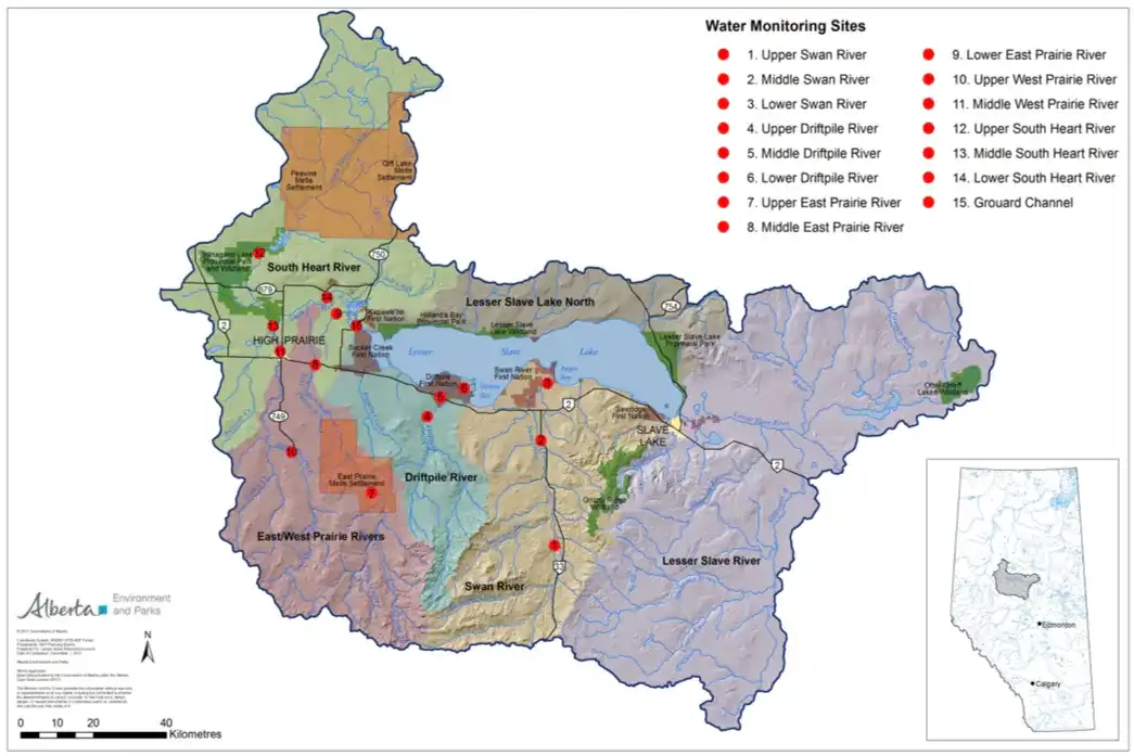
The Lesser Slave Watershed covers the geographic area that drains into Lesser Slave Lake, eventually flowing into the Lesser Slave River before joining up with the main stem of the Athabasca River. As suggested by the Integrated Watershed Management Plan, sampling takes place on the 5 main tributaries of Lesser Slave Lake. An upper, mid and lower sampling site were selected for each tributary.
Sampling Methodology
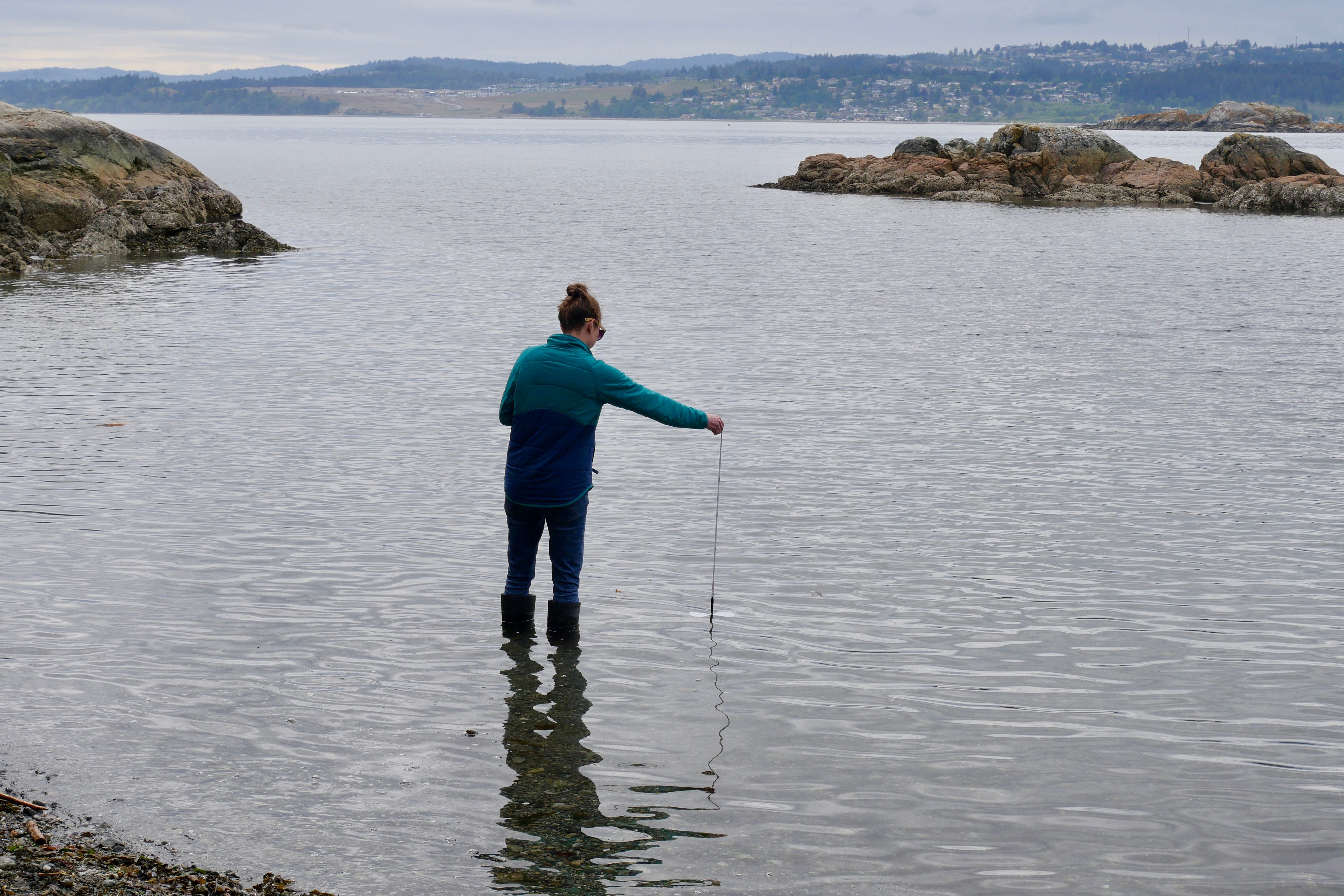
Annual sampling begins at the end of April or early May each year depending on when the ice breaks up. The goal is to complete 10 sampling events each year between April and November at each of the 15 locations.
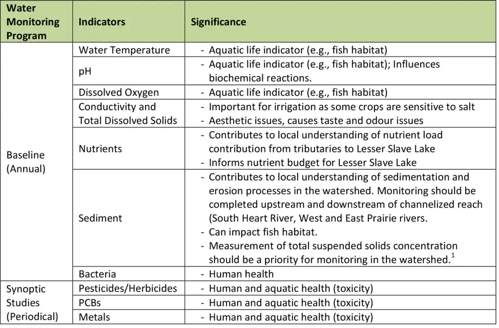
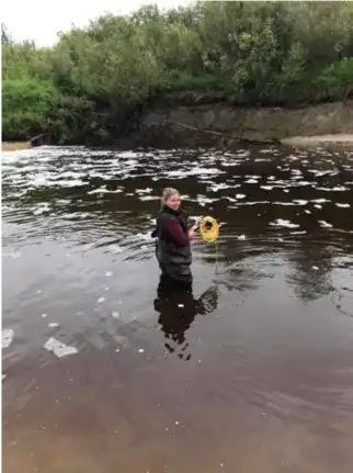
The LSWC has equipment for 2 field crews to measure temperature, pH, conductivity, and dissolved oxygen. These parameters are measured in the field each time samples are collected along with other field observations like air temperature. At this point in time we are focusing on collecting baseline annual data and do not have any periodical synoptic studies planned.
Project goals
The LSWC’s Lesser Slave Watershed Management plan recommends a long-term water monitoring strategy for the watershed. This program will help us achieve the water quality target outlined in the plan:
“Water quality in tributaries to Lesser Slave Lake, and in the Lesser Slave River, should meet provincial water quality guidelines established to protect fish and other aquatic life, as well as meet needs of human use (e.g., water supplies, aesthetics, recreation, waste assimilation).”
Goals for this program include:
- Collect baseline data for tributaries contributing to Lesser Slave Lake;
- Evaluate water quality condition by comparing it to available federal and provincial water quality guidelines and objectives for varying uses (e.g., irrigation, contact recreation, aquatic life), and reference conditions;
- Collect long-term suspended sediments data that can be used to identify the sources of suspended sediment and transport mechanisms in the Lesser Slave watershed;
- Maintain long-term records to examine trends in relationship to land cover and land use activities in the watershed;
- Collect data that will be useful for refining water quality model calibrations, and calculating sediment load and nutrient budgets. Studies regarding sediment transport and nutrient loading to Lesser Slave Lake (AMEC 2005; Hutchinson et al. 2015) have been limited by the low frequency, density, and inconsistency of water monitoring activity in the watershed.
The LSWC would like to thank all of our sponsors and supporters for making this program possible. Especially Vanderwell's Contractors who have made a 5-year commitment of financial support to the program which will enable us to collect much needed baseline data; we would also like to recognize West Fraser, Vermillion Energy, Summerland Energy Inc., The Town of High Prairie and Big Lakes County for their Support. Lastly, we would like recognize Swan River First Nation as Project Partners, we have been able to collaborate and collect more detailed water quality information for our three sites on the Swan River.
For more information on the Lesser Slave Watershed Council and their Tributary Monitoring Program you can visit: https://www.lswc.ca/water_quality_monitoring where the 2017 sampling results summery is available for download. You can also email info@lswc.ca or call the office at 780-523-9800.
Explore LSWC tributary monitoring program data on DataStream
About the Author
The Lesser Slave Watershed Council (LSWC) is group of volunteers and board members who work with the provincial government to maintain the health of the Lesser Slave Watershed by delivering on the three Water for Life goals in the watershed. These include: safe, secure drinking water; healthy aquatic ecosystems; and reliable, quality water supplies for a sustainable future.
The results are in! DataStream's 2023 external evaluation
We asked for your feedback, and you delivered! DataStream is pleased to share the results of our 2023 external evaluation.
Job Posting: Executive Director
The Executive Director (ED) will play a pivotal role in leading DataStream at an exciting time of growth.
Join DataStream's Pacific Data Drive
Do you collect water quality data in British Columbia or the Yukon? If YES, we want to work with you!